
Spartan Forge: Hunt
Spartan Forge · Other
Spartan Forge: Hunt is an AI hunting app that predicts deer movement and layers LiDAR maps for whitetail hunters.
About Spartan Forge: Hunt
What Is Spartan Forge: Hunt
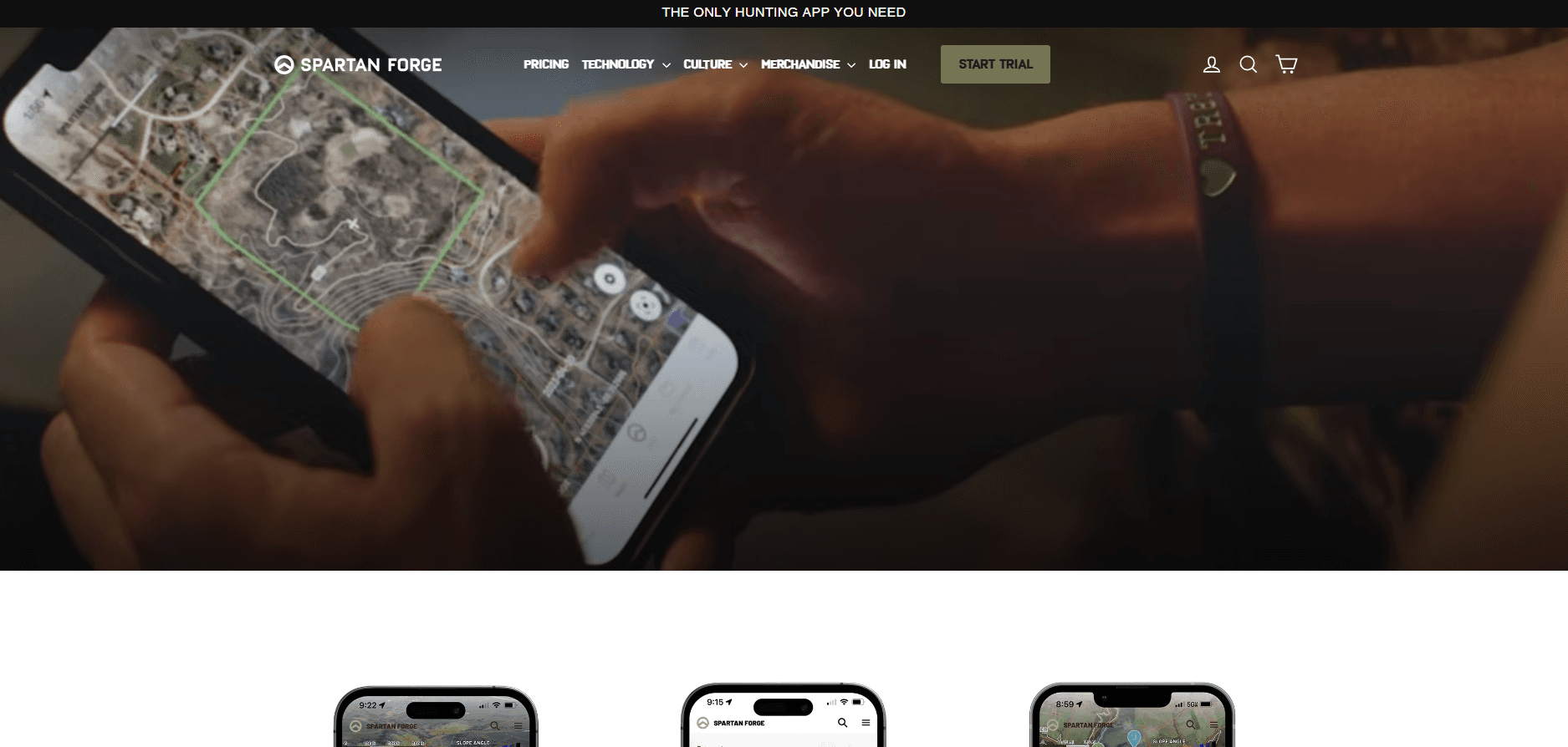
Spartan Forge: Hunt is an e-scouting app built for whitetail deer hunters who want more than a basic topo map. It pairs high-resolution UAV imagery and LiDAR terrain layers with a neural network that forecasts when and where deer are likely to move. The pitch is simple. Instead of guessing from trail camera photos and gut feeling, you let data narrow down where to sit.
The app comes from Spartan Forge, a team that leans hard into military targeting tech and machine learning. That background shows in the toolset. You get a flat, configurable map with land ownership boundaries, offline caching for spots with no signal, and a live pin-sharing feature so a hunting group can coordinate in real time. Most of the core scouting work happens inside one screen. That means marking a ridge or comparing three years of aerial imagery without juggling apps.
The catch is scale and fit. The LiDAR coverage reaches roughly 66% of the Lower 48, so hunters outside that footprint are paying for a headline feature they can't actually use at home. It's also whitetail-first.
Getting Started
- Create an account at map.spartanforge.ai or download Spartan Forge: Hunt from the App Store or Google Play.
- Start the 7-day free trial to open the paid scouting layers, or stay on the free plan.
- Open the map and drop pins on the terrain you want to hunt.
- Turn on the LiDAR and image layers to read ridges, draws, and bedding cover that a standard aerial photo hides.
- Check the deer movement prediction for your area. Save your map layers so they're ready before the season opens.
Product Information
A quick look at Spartan Forge: Hunt's pricing, supported platforms, and performance.
Best for
The users, tasks, and scenarios where this tool fits best.
Users
- Whitetail deer hunters
- Hunting groups and clubs
- Public-land hunters
Tasks
- E-scouting a new property
- Timing a sit
- Reading steep ground
Scenarios
- Planning an out-of-state trip
- Hunting deep with no cell service
- Comparing terrain across seasons
Key features
Deer Movement Prediction
This is the feature Spartan Forge hangs its hat on. It runs a neural network trained on GPS collar data from university research to estimate whitetail movement based on weather and terrain in your area. You check it before a sit. That tells you whether a spot is worth the walk. The company claims it's the only hunting app predicting deer movement this way.
LiDAR and UAV Imagery
LiDAR lets you see through tree canopy and pick out subtle terrain features that a standard aerial photo hides. The UAV imagery runs at 15cm resolution, sharp enough to spot fence lines and small cover changes. LiDAR coverage sits at roughly 66% of the Lower 48. Check your state before you count on it.
Historical Imagery Layers
You can flip back through 3 to 10 years of aerial imagery across about 60% of the U.S. That matters when you're trying to figure out why deer use a certain fencerow. Cover changes. Crops rotate. Water moves. A single snapshot can't show any of that.
Blue Force Tracker Pin Sharing
Borrowed from military targeting, this lets you draw a boundary on the map and invite hunting buddies into the group. Any pin dropped inside that polygon gets shared with the team automatically. It's a clean way to run a drive. No group texts flying around.
Land Ownership and Boundaries
The map shows public and private property lines and ownership, so you know exactly where a parcel ends. That's the difference between a legal sit and a trespassing ticket. It matters.
Offline Maps and Weather
Maps cache to your phone so navigation and pins keep working without cell service. That's normal in good hunting country. An hourly forecast and historical wind data sit right on the map. Wind direction is often the whole ballgame when you're picking a stand.
Eagle Eye and Topo Tools
Eagle Eye gives you a side-profile view of terrain and vegetation. Most apps only show you top-down. Configurable topo maps with 10-foot contour lines and slope angle overlays round out the terrain reading. Split-screen mode on the web compares topo and aerial side by side.
Pros and cons
Pros
- Deer movement prediction is genuinely rare among hunting apps and backed by real collar data.
- LiDAR and 15cm UAV imagery beat what most hunting map apps offer for terrain reading.
- Live pin sharing is well suited to groups and leases, and pins sync automatically inside a boundary.
- Offline maps and wind forecasts work in the field where signal drops.
- A free plan and a 7-day trial let you test the paid layers before committing.
Cons
- LiDAR coverage only reaches about 66% of the Lower 48, so some hunters pay for a feature they can't use locally.
- The prediction engine is whitetail-focused, leaving mule deer, elk, and predator hunters out.
- The free plan is limited, and most of the scouting layers people come for sit behind the subscription.
- Cadence is yearly or monthly with no lifetime option, so the cost adds up season after season.
Frequently asked questions
It's an AI scouting and mapping app for hunters. It predicts whitetail deer movement from weather and terrain data, then layers LiDAR, UAV imagery, and property boundaries onto your map.
Related content
Explore related tools, skills, and articles for Spartan Forge: Hunt.
Spartan Forge: Hunt Alternatives

Odyssey 3
Odyssey · OtherOdyssey-3 is Odyssey's foundation world model. It simulates physics in real time, turns a prompt into an interactive environment, and adapts to robots, cars and games.

JarvisCore
Prescott Data · Coding · Productivity · OtherJarvisCore is an open source Python runtime where AI agents work as equal peers on an agent mesh, claim tasks from a shared ledger, and reach external services through a zero-trust broker.
Clef
Cloudflare · Business · OtherClef is Cloudflare's open-source decision model for Workers AI. It returns calibrated probabilities for typed questions, not generated text, so agents can classify, route, and act fast.