

Textomap
Textomap · Other
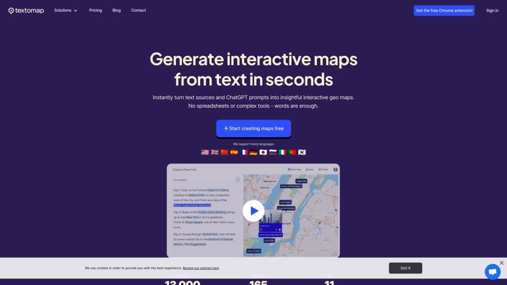
Textomap is a text to map generator that turns text, images, links, CSV files, or AI prompts into interactive maps you can share or embed.
About Textomap
What Is Textomap
Textomap is a web app and AI mapping tool that reads a block of text and plots every place it mentions on an interactive map. Paste a travel itinerary, a news article, or a list of UNESCO sites, and you get pins, labels, and a map you can edit before sharing. A Chrome extension and a WordPress plugin cover the same job inside a browser tab or a blog post.
The problem it solves is grunt work. Building a map by hand usually means collecting addresses, hunting coordinates, and dropping pins one at a time. Textomap detects place names on its own and supports more than 28 languages, including Japanese, Korean, and Arabic, so a foreign-language page works as well as an English one.
The limits matter too. Accuracy depends on how clearly the text names a place, so vague wording like "the old town" can leave a pin off the map. The free plan allows 10 locations per map and 3,000 characters, which is tight for a long feature article. There is no public API, so automated workflows have to run through the extension or plugin.
Getting Started
- Open textomap.com and sign in with an email address. The free plan asks for no card.
- Paste text, drop an image, add a link, upload a CSV, or type a question such as "Map the capitals of Europe."
- Review the detected places, then edit each location card with a name, a short note, a photo, or a link.
- Save the map, then share the link, copy the embed code, or export the locations to Google Maps or a CSV file.
Product Information
A quick look at Textomap's pricing, supported platforms, and performance.
Best for
The users, tasks, and scenarios where this tool fits best.
Users
- Teachers
- Travel agents and tour operators
- Bloggers and content creators
Tasks
- Turning a written itinerary into a visual route
- Mapping the places named in an article
- Plotting a CSV of addresses
Scenarios
- A geography lesson on river systems
- Planning a two-week trip across several countries
- A local news story about a series of events
Key features
Text to Map in Seconds
Paste up to 30,000 characters on a paid plan and Textomap scans for place names, then plots them with labels. It reads 28+ languages, so a Spanish menu or a Japanese train schedule works without translation. The source text stays linked to each pin, which makes fact-checking a map quick.
Maps From Images and Photos
Upload a photo of a hand-drawn route, a scanned map, or a landmark, and this AI map generator identifies the places and adds them to the map. A map from image takes one upload, with no pin placement. This suits old travel journals and printed guides that never had a digital version. The free plan allows 3 image maps, while paid plans remove that cap.
Maps From Links and Web Pages
Drop in a URL and Textomap extracts the locations mentioned on that page, which saves copying and pasting a long article. It works on blog posts, news stories, and listing pages. Free accounts get 3 link maps, so testing the feature takes one paste.
AI Prompt and Question Maps
Type a question the way you would ask a chatbot, such as "Show all UNESCO sites in Italy," and the tool builds a map from the answer. This is the fastest route for a quick overview when you don't have source text. It runs on the same map editor, so you can still rename pins and add notes.
Editable Location Cards
Every pin opens a card where you can change the name, add a description, attach a photo, or link to a booking page or an article. That turns a plain pin drop into a small guide. Custom cards are the main reason a finished map looks presentable enough to publish.
Sharing, Embeds, and Exports
Maps can be shared by link or posted to social media, embedded in a site with an iframe, opened in Google Maps, or exported as a CSV file. The interactive map maker keeps the map editable after publishing, so a corrected pin updates the same link. The WordPress plugin handles the embed step inside a post, and the Chrome extension creates a map without leaving the page you are reading. View limits apply per plan, from 10 shared views a month on the free tier to 3,000 on Pro.
Pros and cons
Pros
- Location detection removes the slowest part of map building, since you never type coordinates or maintain a spreadsheet.
- The input range is wide: text, images, URLs, CSV files, and plain-language questions all lead to the same editor.
- Multilingual detection covers 28+ languages, which helps with foreign news sources and travel documents.
- Embeds and exports cover the common publishing paths, including WordPress, Google Maps, and CSV.
- The free plan needs no card and is enough to test image, link, and prompt maps before paying.
Cons
- There is no public API, so teams that want to generate maps inside their own product can't connect it to a pipeline.
- The free plan allows only 10 locations and 3,000 characters per map, which rules out long articles and big address lists.
- Shared map views are capped at 10 per month on free and 500 on Basic, so a popular embed will hit the ceiling fast.
- Detection misses indirect place references, and you have to fix those pins by hand.
Frequently asked questions
It converts content that mentions places into an interactive map. You can start from text, an image, a web page, a CSV file, or a question typed in plain language, then edit the pins and share the result.
Related content
Explore related tools, skills, and articles for Textomap.
Textomap Alternatives

JarvisCore
Prescott Data · Coding · Productivity · OtherJarvisCore is an open source Python runtime where AI agents work as equal peers on an agent mesh, claim tasks from a shared ledger, and reach external services through a zero-trust broker.
Clef
Cloudflare · Business · OtherClef is Cloudflare's open-source decision model for Workers AI. It returns calibrated probabilities for typed questions, not generated text, so agents can classify, route, and act fast.

iFixAi
iFixAi · Business · OtheriFixAi is an open-source auditor for AI agents. It runs your agent through a simulation of your business, grades every reply, and returns an A to F scorecard backed by evidence.