

Picarta
Picarta S.r.l. · Image
Picarta is an AI photo geolocation tool that studies the visual clues in an image and predicts where it was taken. Upload a picture and it returns GPS coordinates, a city, and a country.
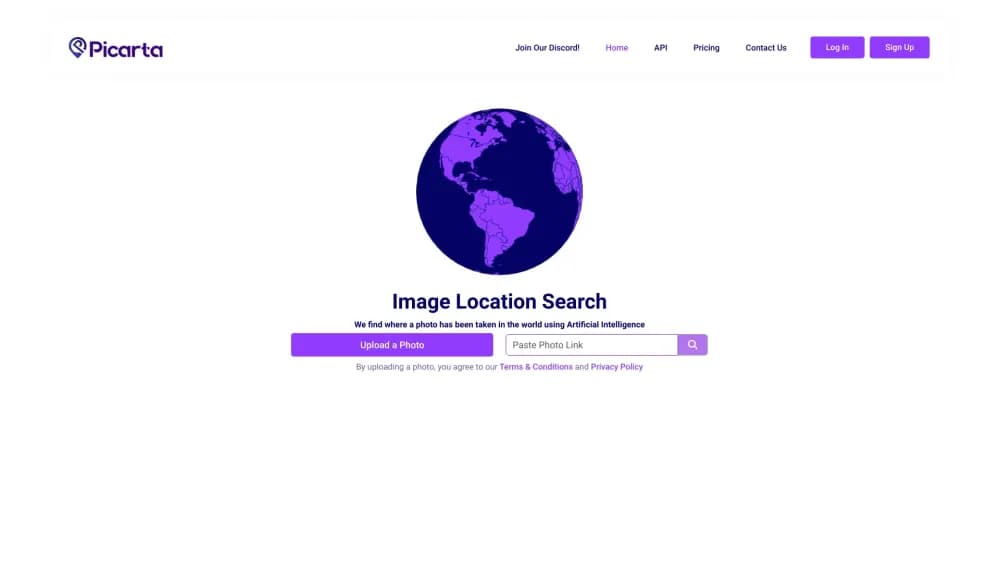
About Picarta
What Is Picarta
Picarta is a web service that figures out where a photo was taken by looking at what's in it. You upload an image or paste an image link, and a machine learning model identifies geographical cues like architecture, terrain, vegetation, and signage. It then returns the most likely GPS coordinates, along with a city and country, plus a confidence score for each guess.
The problem it solves is a common one for anyone who handles images. Photos get shared without location data all the time, and the metadata that once held GPS coordinates is often stripped or edited. Picarta is a photo location finder that reads the pixels instead. It works as a photo geolocation tool on travel shots, social media posts, screenshots, and edited photos where the location tag is gone, and it's built for image geolocalization rather than metadata lookups. Founded in August 2023 and based in Italy, it markets itself to OSINT investigators, journalists, law enforcement, photographers, and researchers.
The main limits are about certainty. Picarta gives estimates, not confirmed locations. Accuracy depends on how distinctive the scene is. A street with a famous landmark and a sign gives the model more to work with than a featureless field. Treat the top results as candidates to review, not a final answer. Also check your own photos: a bad match is always possible, and you should confirm before acting on any prediction.
Getting Started
- Create an account at picarta.ai. The free plan gives you a limited number of searches, so sign up first if you want to test the tool.
- Upload a photo from your device, or paste a public image link. You can also point the search at a specific country or region if you already have a rough idea where the shot was taken.
- Review the results. Picarta shows its top predicted locations on a map, each with GPS coordinates and a confidence score, so you can compare the candidates.
- Confirm the match. Cross-check the prediction against visible details in the photo, like signage or landmarks, before you rely on it.
Product Information
A quick look at Picarta's pricing, supported platforms, and performance.
Best for
The users, tasks, and scenarios where this tool fits best.
Users
- OSINT investigators
- Journalists and fact-checkers
- Photographers and travelers
- Researchers and historians
Tasks
- Finding where a photo was taken
- Verifying image authenticity
- Placing archival photos on a map
- Spotting photo-worthy locations
Scenarios
- Checking a social post before you share it
- Kicking off a research task
- Finding a location from a saved screenshot
Key features
AI Photo Geolocation and Image Geolocalization
This is the core of the tool. You give Picarta an image, and its model analyzes the visual content to estimate where the photo was captured. It looks at architecture, terrain, vegetation, and signage to build a guess, then returns GPS coordinates, a city, and a country. The model works on streets, buildings, outdoor scenes, and landmarks, and it doesn't need any location data baked into the file.
Works Without EXIF or GPS Data
Picarta doesn't rely on EXIF metadata or embedded GPS tags. It predicts location purely from what the picture shows. That's what makes it useful on screenshots, edited photos, and images where the location data was stripped somewhere along the way, which is the case for a large share of what circulates online.
Confidence Scores and Top Predictions
For each photo, Picarta returns its top predicted locations rather than one absolute answer, and each result is a set of GPS coordinates from a photo. Every prediction comes with a confidence score, so you can see how sure the model is and compare the candidates side by side. The default returns a few results, and you can ask for up to ten GPS predictions.
Region and Area Search
You can narrow a search when you already have a hunch. Set a country code, a region, or a county and district to limit the model to that area. You can also define a center point with a radius of up to 25 kilometers, and add a short text hint about the photo. This keeps the search focused and tends to sharpen the results when you know roughly where the shot was taken.
Geocoding API and SDK
Picarta offers a geolocation API with a Python SDK and REST endpoints for JavaScript, curl, and wget. Developers can geolocate images from a local file or a URL, pass the same narrowing options, and get structured predictions back. This makes it practical to fold image location into your own pipeline instead of running every image through the web app by hand. When a team needs to find photo location at scale, the geolocation API is the route that fits.
On-Premise Deployment
Beyond the web app and the API, Picarta offers on-premise installation for enterprise and government clients. Organizations that can't send images to a third-party service can run the model on their own infrastructure. It's aimed at teams with strict data handling requirements rather than individual users.
Pros and cons
Pros
- It reads the image itself, so it works on photos with no EXIF or GPS data. That covers screenshots and re-shared content.
- Results come with confidence scores and multiple candidates, which lets you judge a prediction instead of trusting a single answer.
- You can narrow a search by country, region, or a center point with a radius, which sharpens results when you have a rough idea.
- A free plan and a low one-time purchase make it cheap to test before committing, and the API is available for developers.
- It handles a wide range of scenes, including streets, landmarks, and outdoor views, and the model is updated over time.
Cons
- Predictions are estimates, not confirmed locations. A weak-confidence result can be wrong, and you still need to verify anything important.
- Accuracy depends heavily on the scene. A generic or featureless photo gives the model little to work with.
- The API is limited to Enterprise accounts, so individual developers can't just buy access on the standard plans.
- Search counts on paid plans are capped, which can run out quickly during a heavy investigation.
Frequently asked questions
Picarta finds where a photo was taken. You upload an image or paste a link, and the AI predicts the likely location, returning GPS coordinates, a city, and a country. It's built for people who need to verify or discover photo locations.
Related content
Explore related tools, skills, and articles for Picarta.
Picarta Alternatives

Google EmbeddingGemma 2
Google DeepMind · Writing · Image · CodingGoogle EmbeddingGemma 2 is a 740M-parameter open model that turns text, code, images, audio, and video frames into vectors in one 768-dimension space, running on phones and laptops.

Tractionwave
TractionWave · Image · MarketingTractionWave is an AI attention heatmap tool for static ads. Upload a PNG or JPG and it returns predicted attention, ranked hotspots, and fixes before you spend budget.

Imejis.io
Imejis.io · Image · MarketingImejis.io is an AI design studio for agents and marketing teams. Describe an image in plain words, and it writes the copy, builds the layout, reflows it to every size, then exports a finished file.