

Walkable
Bronix · AI Assistant
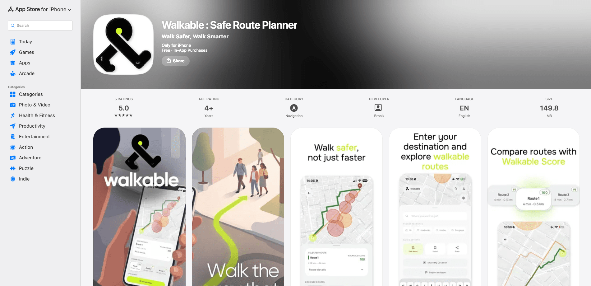
Walkable is an iPhone app that finds you the safest walking route instead of the fastest one. As a walking route safety app, it uses AI-powered analysis to score every option from 0 to 100, weighing street lighting, foot traffic, visibility, and known danger zones, then ranks up to three routes so you can pick the one that feels right. The app is built for night commuters, travelers in unfamiliar cities, and anyone who'd rather trade a few extra minutes for peace of mind on foot.
About Walkable
What Is Walkable
Walkable is a pedestrian safety app and iOS safe walking app developed by Bronix. It reframes how you plan a walk. Most navigation tools treat speed as the only variable worth cutting. Walkable adds a second one. How safe does the street actually feel after dark?
Think of it as a night walking app first. If your commute home happens in the dark, the scoring matters more than the distance.
The core of the app is the Walkable Score, a 0-100 safety rating attached to each route. The number comes from an AI analysis of real-world signals like lighting, pedestrian traffic, visibility, and historical safety data. That score is what separates it from a normal map. You're not just choosing between a short path and a long path anymore. You're choosing between options ranked by risk.
The main limitation is scope. Walkable runs on iPhone only, needs iOS 15.6 or later, and hands off turn-by-turn guidance to Google Maps instead of steering you itself. It's a planning layer. It won't replace your maps app. It sits on top of it.
Getting Started
- Download Walkable from the App Store and open it on an iPhone running iOS 15.6 or later.
- Enter your starting point and destination to request safe route options.
- Let the AI safety analysis run, then review the Walkable Score and danger-zone highlights for each route.
- Compare up to three ranked options and pick the one matching your comfort level.
- Tap to hand the chosen route to Google Maps for turn-by-turn navigation, then rate the trip to help tune future recommendations.
Product Information
A quick look at Walkable's pricing, supported platforms, and performance.
Best for
The users, tasks, and scenarios where this tool fits best.
Users
- Night commuters
- Travelers
- Safety-conscious daily walkers
Tasks
- Planning a night walk home
- Comparing route options
- Checking a neighborhood before you walk it
Scenarios
- Leaving a train station late at night and wanting the better-lit way back.
- Exploring a new city on foot and avoiding streets with poor visibility.
- Sticking to familiar safe routes
Key features
AI Safety Analysis
Every route gets evaluated against real-world factors instead of raw distance. The model weighs street lighting, pedestrian traffic, visibility, and historical safety data to estimate how exposed a walk leaves you. The output isn't a vague warning. It's a number. That number is something you can act on.
Walkable Score
The 0-100 Walkable Score turns a pile of safety signals into a single rating for each route. Higher means safer. That's it. It's the fastest way to see which option deserves a closer look, and it keeps comparisons honest when two paths look similar on the map.
Night Mode
Night Mode routes differently once the sun's down. It accounts for reduced lighting and lower foot traffic, two things that change how a street feels after midnight. If your walk home happens in the dark, this is the mode you'll actually use.
Danger Zone Map
Before you take a single step, the danger zone map highlights risk areas on your route. It's a preview, not a guarantee. Still, seeing the spots flagged in advance lets you decide whether the path is worth it or whether a detour makes more sense.
Multi-Route Comparison
Walkable returns up to three route options ranked by safety, not by how quickly they get you there. You can weigh a slightly longer, better-lit path against a shorter, dimmer one and make the call yourself, which is exactly the kind of trade-off a normal map never shows you. That choice is the whole point of the app.
Google Maps Handoff
Pick your route and tap to open it in Google Maps for turn-by-turn navigation. Walkable handles the safety planning. Google handles the directions you already trust. It's a clean split of duties, and it means you're not relearning a whole navigation interface.
Trip Ratings
After each walk, you can rate the trip. Those ratings feed back into how routes get recommended over time, so a street that felt sketchy to you stops getting pushed to people with a similar route. One rating won't change much, but consistent feedback is how the app learns which streets work.
Save Routes
You can store your regular safe routes for quick access. If you walk the same path to the station every week, saving it skips the planning step entirely. No re-entering addresses. No re-checking the score.
Pros and cons
Pros
- Scores routes on lighting, foot traffic, visibility, and historical safety data instead of distance alone.
- Night Mode tailors routing to after-dark conditions like poor lighting and empty streets.
- Danger zone map gives you a look at risk areas before you commit to a path.
- Ranks up to three options by safety, so the decision stays in your hands.
- Hands off to Google Maps, so navigation still feels familiar.
Cons
- iPhone only, which rules it out entirely for Android users.
- It plans routes but doesn't give turn-by-turn guidance, so you'll switch apps to actually walk.
- The free tier limits how much you can plan, and Pro pricing isn't published on the App Store listing.
Frequently asked questions
It scores walking routes for safety, from 0 to 100, using AI analysis of factors like lighting, foot traffic, and danger zones. You get a set of route options ranked by safety so you can choose the one that fits your comfort level.
Related content
Explore related tools, skills, and articles for Walkable.
Walkable Alternatives

Iplan AI
Iplan AI · Productivity · AI AssistantIplan AI is an AI travel planner that turns a few trip details into a full day-by-day itinerary in seconds. You answer questions about your destination, interests, budget, and travel companions, and the tool builds a plan you can edit, share, and carry with you on any device. It targets travelers who want a solid draft without spending hours in spreadsheets and browser tabs. Think of it as an itinerary generator that does the tedious part for you.

Screenhelp
Screenhelp · Productivity · AI AssistantScreenhelp is an AI screen assistant that turns a single keyboard shortcut into real-time help. You press Ctrl+Shift+Space, it captures what's on your screen, and it streams an answer into a private panel in about two seconds. Think of it as an AI screenshot helper you trigger on demand. It runs on Mac, Windows, and the web, starts free with 30 answers a month, and stays invisible during screen sharing on Zoom, Teams, and Google Meet.

Rainbow
Rainbow · AI AssistantRainbow is an AI weather forecast app built around short-term precipitation nowcasting. Its engine pushes min-by-min rain and snow predictions up to four hours ahead, blending live satellite and radar feeds into hyperlocal forecasts. The app adds live rain radar, a seven-day outlook, precipitation alerts, home-screen widgets, and a hurricane tracker, and it runs on both Android and iOS with a free tier plus paid upgrades.